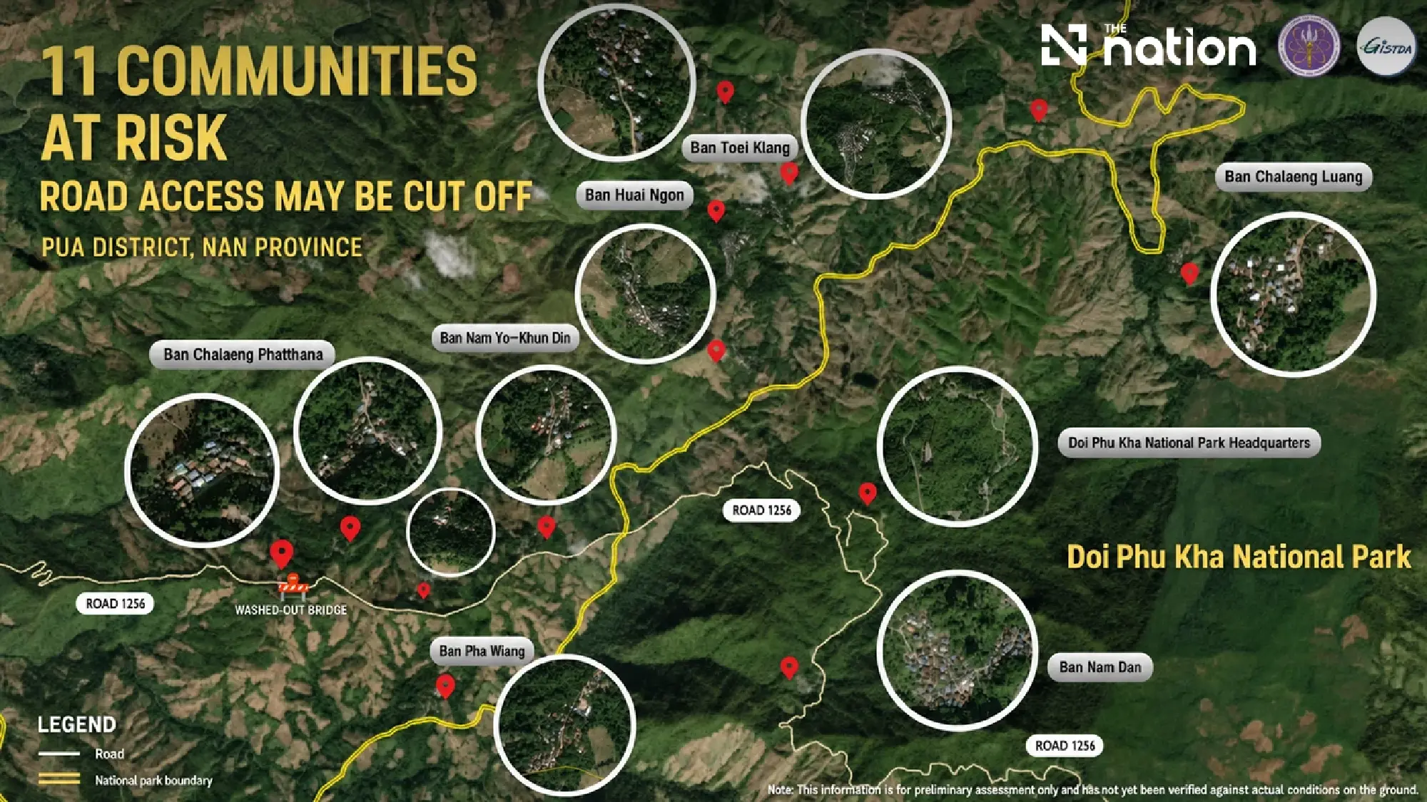
GISTDA warns that heavy rain, flash floods or landslides could sever access to 11 mountain communities in Bo Kluea district, Nan
Eleven mountain communities in Bo Kluea district, Nan province, could be cut off if continuing rain causes flash floods, landslides or damage to their limited access routes, GISTDA has warned.
The Geo-Informatics and Space Technology Development Agency (Public Organization), under the Ministry of Higher Education, Science, Research and Innovation, used geospatial information to analyse roads and waterways in support of risk monitoring.
Limited routes increase isolation risk
Continuing rainfall in Bo Kluea has raised concerns for 11 communities in mountainous areas where transport connections are limited.
Heavy rain or rapid run-off could damage roads and prevent vehicles from travelling into or out of these communities.
The locations identified in the warning include:
Ban Daeng Phatthana
Ban Huai Ngop
Ban Huai–Khun Din
Ban Toei Lang
Ban Daeng Luang
Ban Kha Wiang
Ban Nam Thin
Other communities situated along identified risk areas
Analysis identifies vulnerable access points
GISTDA combined information on road and transport networks with waterways, community locations and surrounding terrain.
The analysis was used to assess which communities could lose access if heavy rain caused flash floods, rapid forest run-off or landslides.
It also highlighted the relationship between communities, roads and waterways, allowing potential transport bottlenecks to be identified more clearly.
Data supports emergency planning
The findings can help relevant agencies plan monitoring measures, prepare alternative routes and support emergency access to affected residents.
Continued geospatial monitoring will allow authorities to reassess transport risks and prepare an appropriate response as conditions change.